WY 22 Corridor Project
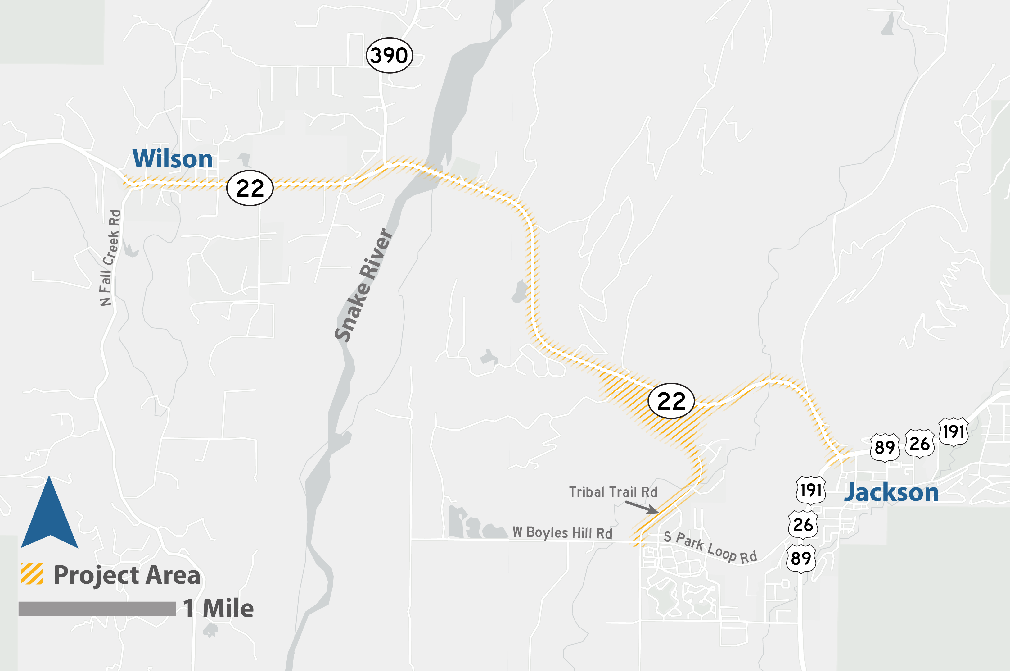
The Wyoming Department of Transportation (WYDOT) and the Federal Highway Administration, in cooperation with the Town of Jackson and Teton County, have initiated an environmental and design project on WY 22. The WY 22 Corridor Project extends from the US 89/WY 22 intersection (known locally as the Y intersection) with Broadway Avenue through Wilson and includes existing Tribal Trail Road to S. Park Loop/W Boyles Hill roads.
WYDOT is seeking public comment on the WY 22 Corridor Project. Please click HERE to submit your comments.
EMAIL UPDATES
Sign-up here for project updates.
WY 22 Corridor Press Release
WY 22 Corridor Improvements
WHO?
The Wyoming Department of Transportation (WYDOT) and the Federal Highway Administration, in cooperation with the Town of Jackson and Teton County, are in the early phases of environmental analysis and design of improvements to the WY 22 corridor. This project will also include input from the public and other federal, state, and local agencies.
WHAT?
A corridor analysis including environmental and design for WY 22 from the Y-intersection with Broadway Avenue through Wilson
This project involves identifying transportation needs and improvements to WY 22 and analyzing associated impacts by working with stakeholders and the public.
WHY?
Consider transportation needs and solutions for the WY 22 corridor.
Previous WYDOT and local studies have identified the need for safety and mobility improvements in the corridor. Congestion severely impacts the ability of residents and visitors, as well as emergency service providers, to safely and efficiently reach desired destinations within the corridor and beyond. The corridor experiences a high number of animal-vehicle collisions. Jackson’s and Teton County’s transportation planning efforts have underscored the need for travel redundancy in the areas accessed by WY 22.
HOW?
With input from stakeholders, advisory teams, technical experts, and you!
WYDOT wants to hear from stakeholders and members of the public. To get involved, sign up for updates and attend meetings.
WHERE?
The WY 22 Corridor Project extends from the US 89/WY 22 intersection (known locally as the Y intersection) with Broadway Avenue through Wilson and includes existing Tribal Trail Road to S. Park Loop/W Boyles Hill roads.
Other local projects include the Teton Mobility Corridor Improvements BUILD Grant Project.